
Shop Products
- Gift Cards
- Apparel & Footwear
- Appliances
- Automotive
- Building Materials
- Cleaning
- Doors & Windows
- Electrical
- Hardware
- Fasteners
- Flooring
- Home Goods & Decor
- Heating, Cooling & Ventilation
- Holiday
- Lighting & Ceiling Fans
- Kitchen & Bath
- Lawn & Garden
- Paint
- Plumbing
- Outdoor Living
- Storage & Organization
- Pet & Wild Bird
- Sports & Recreation
- Tools
Services
Inspiration
About Us
Contact Us
Rewards
- Home
- Products
- Home Goods & Decor
- Office & Store Supplies
- Books, Maps & Planners
- Maps
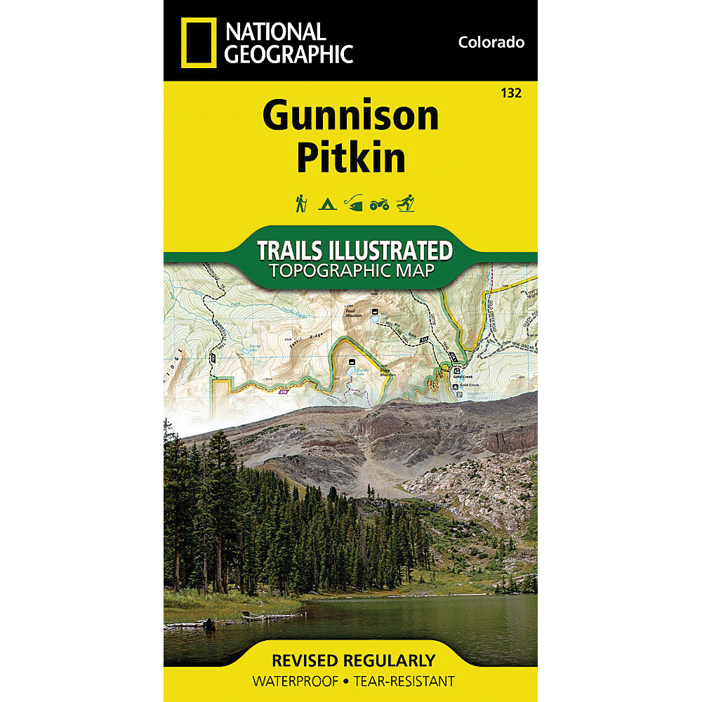
- National Geographic TI00000132

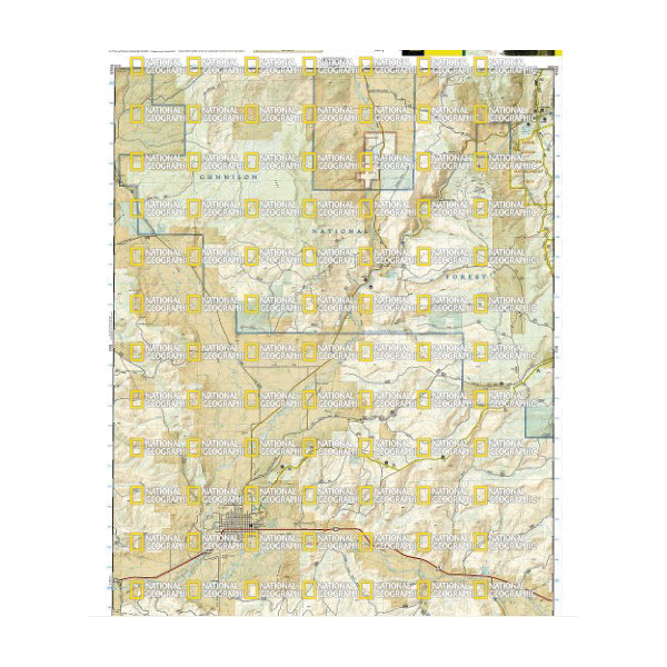
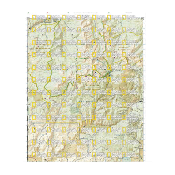
National Geographic TI00000132 Gunnison, Pitkin Map, 32 in L, 22 in W

Promo Price:
National Geographic TI00000132 Gunnison, Pitkin Map, 32 in L, 22 in W
National Geographic's Trail Illustrated map of Gunnison and Pitkun offers unparalleled detail for outdoor enthusiasts exploring this scenic area on the western slope of the Colorado Rockies. Expertly researched and created in partnership with the U.S. forest service and others, the map covers parts of Gunnison National Forest, Fossil Ridge Wilderness and Recreation Management Areas, Roaring Judy State Wildlife Area and the city of Gunnison. The map features many points of interest, including Taylor and Gunnison Rivers, Flat Top, Square Top and Fossil Mountains and Fossil Ridge.
| Continental Coverage | Taylor and Gunnison Rivers, Flat Top, Square Top and Fossil Mountains and Fossil Ridge |
| Material | Paper |
| Length | 32 in |
| Width | 22 in |
- Every trails illustrated map is printed on backcountry tough waterproof, tear-resistant paper
- Full UTM grid is printed on the map to aid with GPS navigation