
Shop Products
- Gift Cards
- Apparel & Footwear
- Appliances
- Automotive
- Building Materials
- Cleaning
- Doors & Windows
- Electrical
- Hardware
- Fasteners
- Flooring
- Home Goods & Decor
- Heating, Cooling & Ventilation
- Holiday
- Lighting & Ceiling Fans
- Kitchen & Bath
- Lawn & Garden
- Paint
- Plumbing
- Outdoor Living
- Storage & Organization
- Pet & Wild Bird
- Sports & Recreation
- Tools
Services
Inspiration
About Us
Contact Us
Rewards
- Home
- Products
- Home Goods & Decor
- Office & Store Supplies
- Books, Maps & Planners
- Maps
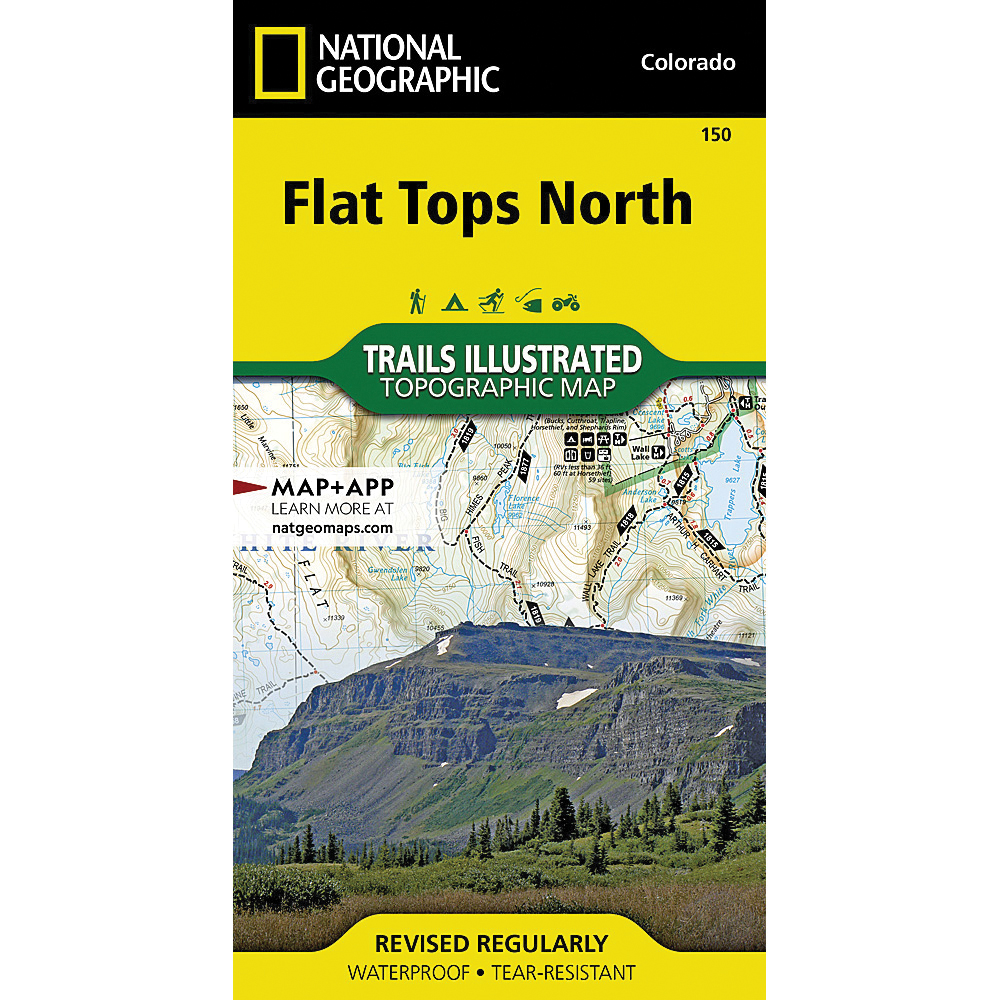
- National Geographic TI00000150

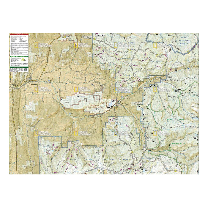
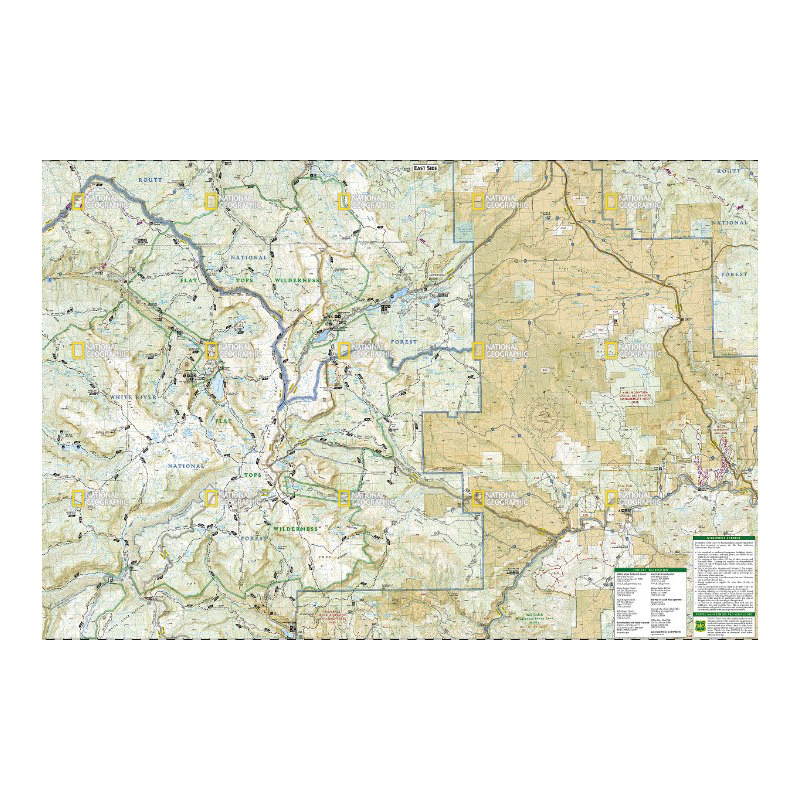
National Geographic TI00000150 Flat Tops North Map, 37-3/4 in L, 25-1/2 in W

Promo Price:
National Geographic TI00000150 Flat Tops North Map, 37-3/4 in L, 25-1/2 in W
Flat Tops is Colorado's second largest wilderness. National Geographic's Trails Illustrated map of Flat Tops North delivers unmatched detail and valuable information to assist you in your exploration of this scenic region of flat-topped mountains, subalpine terrain, alpine tundra and hundreds of streams, lakes and ponds. Created in partnership with local land management agencies, this expertly researched map features key areas of interest including Oak Ridge State Wildlife Area, North Fork White River, Flat Tops Trail Scenic Byway, Meeker, Trappers Lake and Yamcolo and Stillwater reservoirs.
| Continental Coverage | Oak Ridge State Wildlife Area, North Fork White River, Flat Tops Trail Scenic Byway, Meeker, Trappers Lake and Yamcolo and Stillwater Reservoirs |
| Material | Paper |
| Length | 37-3/4 in |
| Width | 25-1/2 in |
- Every trails illustrated map is printed on backcountry tough waterproof, tear-resistant paper
- Full UTM grid is printed on the map to aid with GPS navigation