Boulder, CO · 2525 Arapahoe Ave
STORE HOURS:

Shop Products
- Gift Cards
- Apparel & Footwear
- Appliances
- Automotive
- Building Materials
- Cleaning
- Doors & Windows
- Electrical
- Hardware
- Fasteners
- Flooring
- Home Goods & Decor
- Heating, Cooling & Ventilation
- Holiday
- Lighting & Ceiling Fans
- Kitchen & Bath
- Lawn & Garden
- Paint
- Plumbing
- Outdoor Living
- Storage & Organization
- Pet & Wild Bird
- Sports & Recreation
- Tools
Services
Inspiration
About Us
Contact Us
Rewards
- Home
- Products
- Home Goods & Decor
- Office & Store Supplies
- Books, Maps & Planners
- Maps
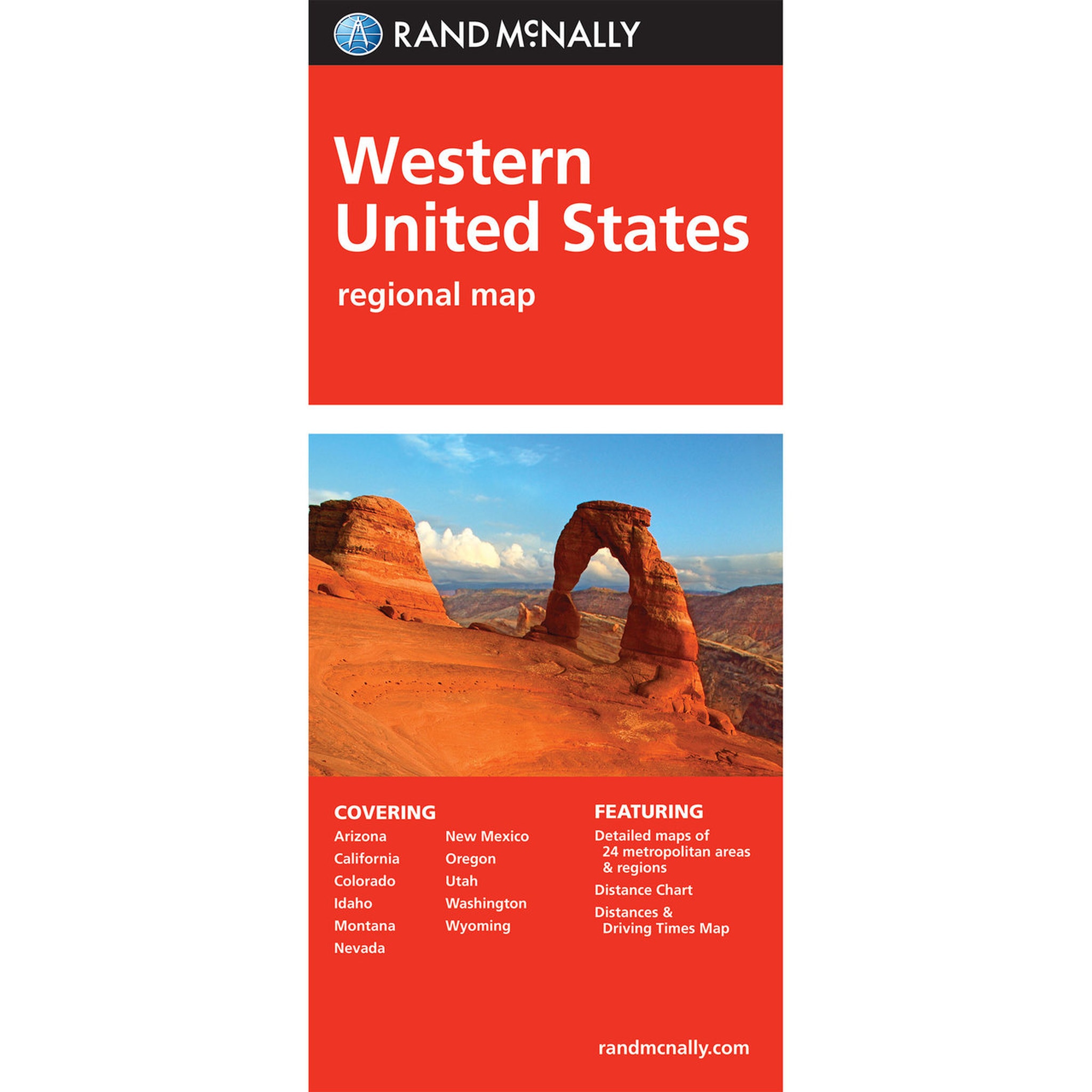
- Rand McNally 528882112

Rand McNally
Rand McNally 528882112 Folded Map, 40 in L, 28 in W, Western United States
MPN: 528882112
•
SKU: 102411740
• UPC: 070609025179
Store SKU:

Supplier SKU:
Customer Part Number:
Promo Price:
Volume Discounts
How Would You Like to Get It?
Store Pickup / Curbside
Check in-store availability · Ready same day
FREE
Ship to Me
Standard shipping · 5–7 business days
FREE
Local Delivery
Same-day in Boulder · Order before 2pm
$9.99
Need Help Choosing?
Our Green Vest experts can walk you through options or recommend a local pro.
Rand McNally 528882112 Folded Map, 40 in L, 28 in W, Western United States
Rand McNally's folded map featuring the Western United States is a must have for anyone traveling in and around this part of the country, offering unbeatable accuracy and reliability at a great price. Our trusted cartography shows all Interstate, state and county highways, along with clearly indicated points of interest, airports, county boundaries and more. You'll see why Rand McNally folded maps have been the trusted standard for years.
| Continental Coverage | Western United States |
| Length | 40 in |
| Width | 28 in |
- Regularly updated, full-color maps
- Clearly labeled Interstate, US state and county highways
- Detail maps of major cities, a mileage chart and a Mileages & Driving Times Map
- Indications of parks, points of interest, airports, county boundaries and more
- Easy-to-use legend
- Detailed index
- Convenient folded size