
Shop Products
- Gift Cards
- Apparel & Footwear
- Appliances
- Automotive
- Building Materials
- Cleaning
- Doors & Windows
- Electrical
- Hardware
- Fasteners
- Flooring
- Home Goods & Decor
- Heating, Cooling & Ventilation
- Holiday
- Lighting & Ceiling Fans
- Kitchen & Bath
- Lawn & Garden
- Paint
- Plumbing
- Outdoor Living
- Storage & Organization
- Pet & Wild Bird
- Sports & Recreation
- Tools
Services
Inspiration
About Us
Contact Us
Rewards
- Home
- Products
- Home Goods & Decor
- Office & Store Supplies
- Books, Maps & Planners
- Maps
- Sky Terrain 0-9665508-7-0

Sky Terrain 0-9665508-7-0 Trail Map, Big Agnes Mountain, Buffalo Pass, Clark, Columbine, Hahns Peak/Milner

Promo Price:
Sky Terrain 0-9665508-7-0 Trail Map, Big Agnes Mountain, Buffalo Pass, Clark, Columbine, Hahns Peak/Milner
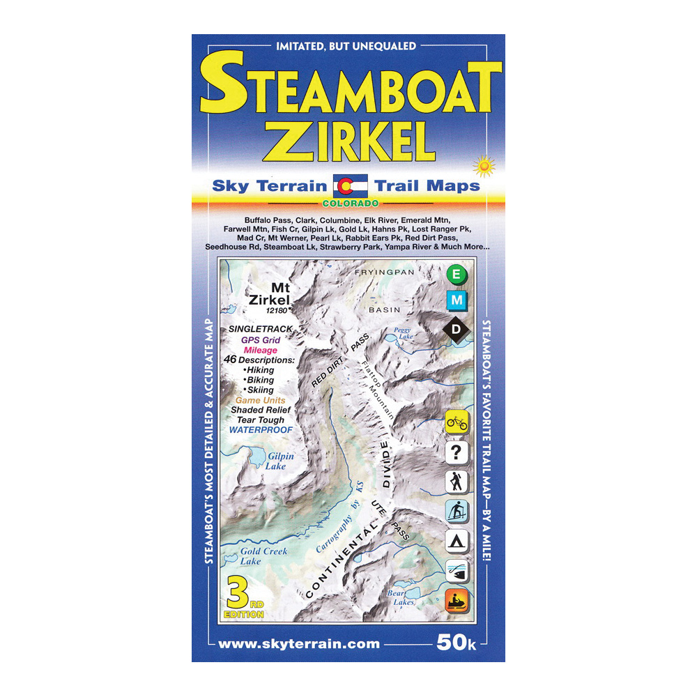
The map is 1, 50,000 scale and covers 16 USGS quads. The towns shown include Steamboat Springs, Clark, Columbine, Hahns Peak and Milner. A huge stretch of the Park Range (and the Continental Divide) is mapped, with the mighty Mount Zirkel at the highest point. Other highpoints are Lost Ranger Peak, The Dome, Mount Ethel, Big Agnes Mountain, Rabbit Ears Peak and conical Hahns Peak. Buffalo Pass, Rabbit Ears Pass, Ute Pass and Red Dirt Pass are shown. The entire and very beautiful Elk River is revealed, as well as a long stretch of the Yampa River and smaller creeks like Soda Creek, Spring Creek, Fish Creek, Mad Creek, Walton Creek and so many more. Whitewater classes and put-ins and take-outs are shown. Steamboat Lake and Pearl Lake provide boating. And numerous alpine lakes such as Luna Lake, Three Island Lake, Gilpin Lake, Gold Creek Lake and Dinosaur Lake. In short, you should see the map to see the amazing territory covered. Extensive field scouting and research went into designing this map. The result is an accurate and up-to-date trail map packed with information. Several trails are published here for the first time. Historical routes are also shown.
| Continental Coverage | Big Agnes Mountain, Buffalo Pass, Clark, Columbine, Hahns Peak/Milner, Mount Ethel, Rabbit Ears Pass, Rabbit Ears Peak/conical Hahns Peak, Red Dirt, Steamboat Springs |
- Two maps cover 8 USGS quads each
- Shading tints and contours enhance elevation cues and organize complex terrain
- Singletrack symbols for mountain biking
- Game management units for hunting
- Trail mileage shown between junctions
- 46 trail descriptions including directions, trail lengths, elevation gains, noteworthy features and more
- Historic routes shown for reference
- Ideal contour levels (80 ft) set to improve visualization of terrain forms and maximize elevation information
- Careful mapping and graphic stressing of natural hydrography to improve comprehension of the terrain forms
- Full UTM grid for easy use with GPS receivers