
Shop Products
- Gift Cards
- Apparel & Footwear
- Appliances
- Automotive
- Building Materials
- Cleaning
- Doors & Windows
- Electrical
- Hardware
- Fasteners
- Flooring
- Home Goods & Decor
- Heating, Cooling & Ventilation
- Holiday
- Lighting & Ceiling Fans
- Kitchen & Bath
- Lawn & Garden
- Paint
- Plumbing
- Outdoor Living
- Storage & Organization
- Pet & Wild Bird
- Sports & Recreation
- Tools
Services
Inspiration
About Us
Contact Us
Rewards
- Home
- Products
- Home Goods & Decor
- Office & Store Supplies
- Books, Maps & Planners
- Maps
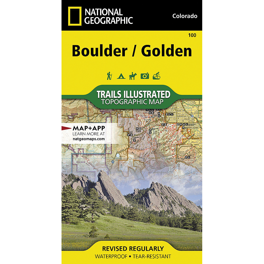
- National Geographic TI00000100

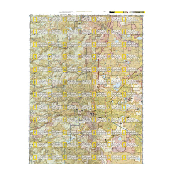
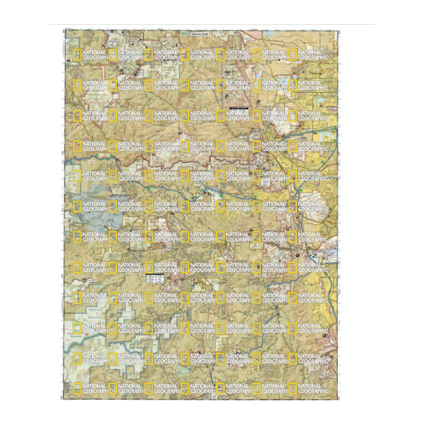
National Geographic TI00000100 Boulder/Golden Map, 37-3/4 in L, 25-1/2 in W

Promo Price:
National Geographic TI00000100 Boulder/Golden Map, 37-3/4 in L, 25-1/2 in W
National Geographic's Trails Illustrated map of Boulder and Golden combines unmatched detail with helpful information to offer an invaluable tool for making the most of your exploration of the central Colorado Front Range. Expertly researched and created in partnership with local land management agencies, this map features key points of interest including Boulder Mountain Park, Clear Creek, Golden Gate Canyon State Park, Alderfer/Three Sisters Park, Lookout Mountain and the iconic Red Rocks amphitheater. The communities of Lyons, Boulder, Golden, Morrison, Aspen Park and Evergreen are also covered on this map.
| Continental Coverage | Boulder Mountain Park, Clear Creek, Golden Gate Canyon State Park, Alderfer/Three Sisters Park, Lookout Mountain and The Iconic Red Rocks Amphitheater, The communities of Lyons, Boulder, Golden, Morrison, Aspen Park |
| Material | Paper |
| Length | 37-3/4 in |
| Width | 25-1/2 in |
- Every trails illustrated map is printed on backcountry tough waterproof, tear-resistant paper
- Full UTM grid is printed on the map to aid with GPS navigation