
Shop Products
- Gift Cards
- Apparel & Footwear
- Appliances
- Automotive
- Building Materials
- Cleaning
- Doors & Windows
- Electrical
- Hardware
- Fasteners
- Flooring
- Home Goods & Decor
- Heating, Cooling & Ventilation
- Holiday
- Lighting & Ceiling Fans
- Kitchen & Bath
- Lawn & Garden
- Paint
- Plumbing
- Outdoor Living
- Storage & Organization
- Pet & Wild Bird
- Sports & Recreation
- Tools
Services
Inspiration
About Us
Contact Us
Rewards
- Home
- Products
- Home Goods & Decor
- Office & Store Supplies
- Books, Maps & Planners
- Maps
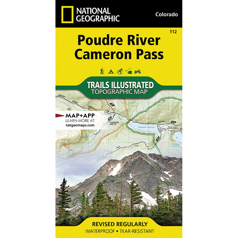
- National Geographic TI00000112

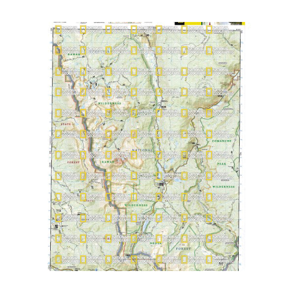
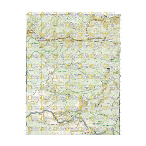
National Geographic TI00000112 Poudre River, Cameron Pass Map, 32 in L, 22 in W

Promo Price:
National Geographic TI00000112 Poudre River, Cameron Pass Map, 32 in L, 22 in W
Outdoor enthusiasts looking to enjoy the pristine areas in southern Roosevelt National Park will find National Geographic's Trails Illustrated map of Poudre River and Cameron Pass an essential travel companion. Expertly researched and created in partnership with the U.S. forest service, Colorado State Parks, the Bureau of Land Management and others, this map will guide you along the trails, over the peaks and across the rivers as you enjoy your adventure or recreation activity. Included in this map are the areas of Comanche Peaks and Rawah Wilderness, Bull Mountain, Bliss State Wildlife Area.
| Continental Coverage | Comanche Peaks and Rawah Wilderness, Bull Mountain, Bliss State Wildlife Area |
| Material | Paper |
| Length | 32 in |
| Width | 22 in |
- Every trails illustrated map is printed on backcountry tough waterproof, tear-resistant paper
- Full UTM grid is printed on the map to aid with GPS navigation