
Shop Products
- Gift Cards
- Apparel & Footwear
- Appliances
- Automotive
- Building Materials
- Cleaning
- Doors & Windows
- Electrical
- Hardware
- Fasteners
- Flooring
- Home Goods & Decor
- Heating, Cooling & Ventilation
- Holiday
- Lighting & Ceiling Fans
- Kitchen & Bath
- Lawn & Garden
- Paint
- Plumbing
- Outdoor Living
- Storage & Organization
- Pet & Wild Bird
- Sports & Recreation
- Tools
Services
Inspiration
About Us
Contact Us
Rewards
- Home
- Products
- Home Goods & Decor
- Office & Store Supplies
- Books, Maps & Planners
- Maps
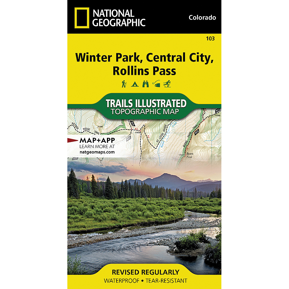
- National Geographic TI00000103

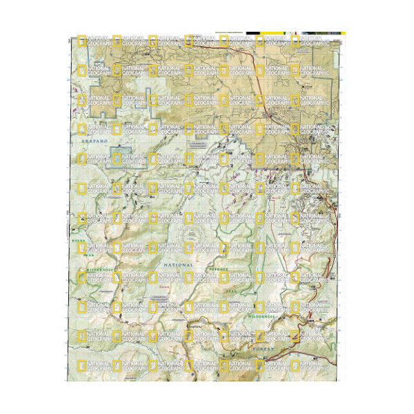
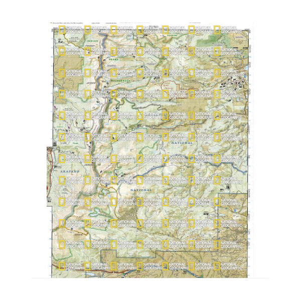
National Geographic TI00000103 Winter Park, Central City, Rollins Pass Map, 32 in L, 22 in W

Promo Price:
National Geographic TI00000103 Winter Park, Central City, Rollins Pass Map, 32 in L, 22 in W
National Geographic's Trails Illustrated map of Winter Park, Central City and Rollins Pass provides unparalleled detail for outdoor enthusiasts seeking to enjoy the year-round recreational opportunities in the southern parts of Roosevelt and Arapaho National Forest. Expertly researched and created in partnership with local land management agencies, this map includes helpful contact information, safety tips. The map features many key areas of interest including Indian, Vasquez and Byers Peaks Wilderness, Arapaho National Recreation Area and Eldora Ski Area.
| Continental Coverage | Indian, Vasquez and Byers Peaks Wilderness, Arapaho National Recreation Area and Eldora Ski Area |
| Material | Paper |
| Length | 32 in |
| Width | 22 in |
- Every trails illustrated map is printed on backcountry tough waterproof, tear-resistant paper
- Full UTM grid is printed on the map to aid with GPS navigation