Boulder, CO · 2525 Arapahoe Ave
STORE HOURS:

Shop Products
- Gift Cards
- Apparel & Footwear
- Appliances
- Automotive
- Building Materials
- Cleaning
- Doors & Windows
- Electrical
- Hardware
- Fasteners
- Flooring
- Home Goods & Decor
- Heating, Cooling & Ventilation
- Holiday
- Lighting & Ceiling Fans
- Kitchen & Bath
- Lawn & Garden
- Paint
- Plumbing
- Outdoor Living
- Storage & Organization
- Pet & Wild Bird
- Sports & Recreation
- Tools
Services
Inspiration
About Us
Contact Us
Rewards
- Home
- Products
- Home Goods & Decor
- Office & Store Supplies
- Books, Maps & Planners
- Maps
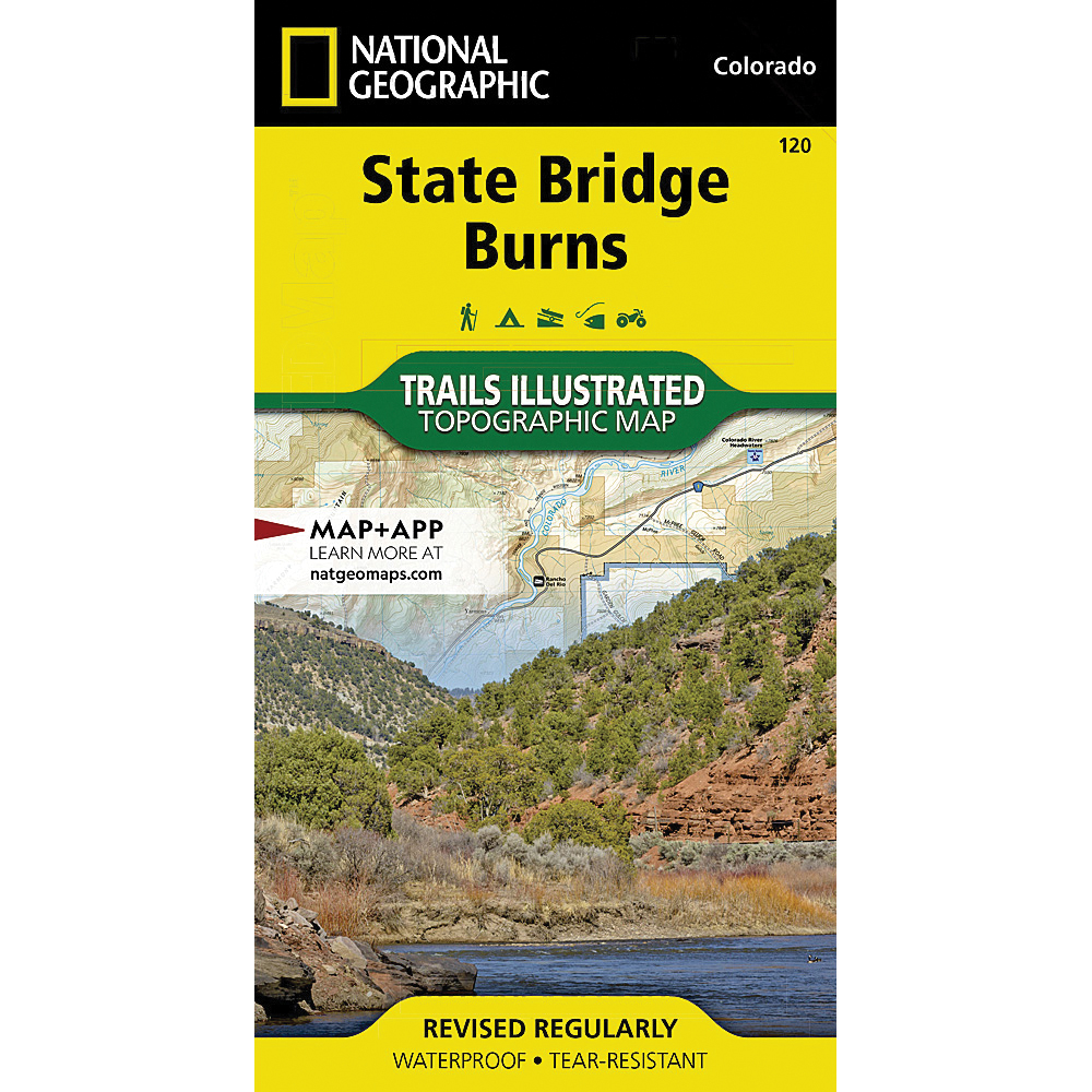
- National Geographic TI00000120

National Geographic
National Geographic TI00000120 State Bridge, Burns Map, 32 in L, 22 in W
MPN: TI00000120
•
SKU: 103737296
• UPC: 749717009509
Store SKU:

Supplier SKU:
Customer Part Number:
Promo Price:
Volume Discounts
How Would You Like to Get It?
Store Pickup / Curbside
Check in-store availability · Ready same day
FREE
Ship to Me
Standard shipping · 5–7 business days
FREE
Local Delivery
Same-day in Boulder · Order before 2pm
$9.99
Need Help Choosing?
Our Green Vest experts can walk you through options or recommend a local pro.
National Geographic TI00000120 State Bridge, Burns Map, 32 in L, 22 in W
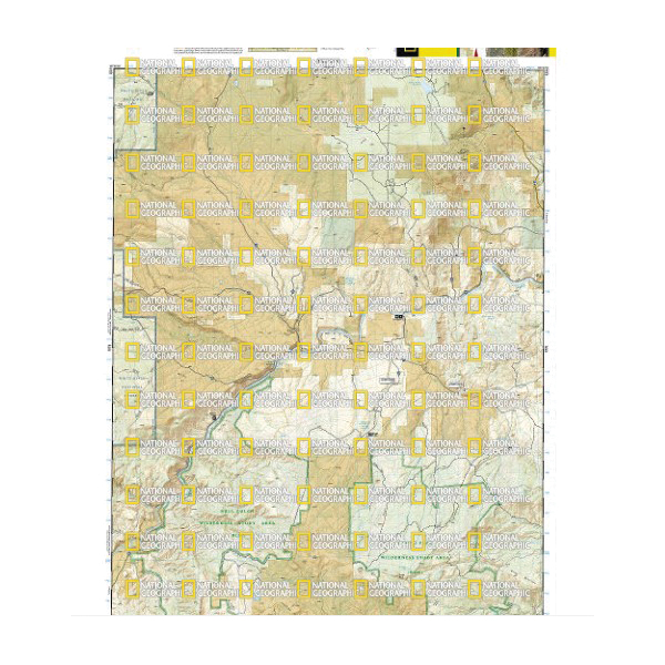
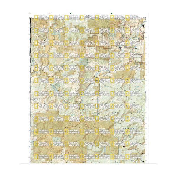
Outdoor enthusiasts seeking to explore the rugged topography of northwestern Colorado will marvel at National Geographic's Trails Illustrated map of state bridge and burns. Created in cooperation with the U.S. forest service, bureau of land management and others, this expertly researched map delivers unparalleled detail of the area. coverage includes White River National Forest, Derby and Congor Mesas, Bull Gulch and Castle Peak Wilderness Study Areas, Radium State Wildlife Area and the Colorado River.
| Continental Coverage | White River National Forest, Derby and Congor Mesas, Bull Gulch and Castle Peak Wilderness Study Areas, Radium State Wildlife Area and the Colorado River |
| Material | Paper |
| Length | 32 in |
| Width | 22 in |
- Every trails illustrated map is printed on backcountry tough waterproof, tear-resistant paper
- Full UTM grid is printed on the map to aid with GPS navigation