
Shop Products
- Gift Cards
- Apparel & Footwear
- Appliances
- Automotive
- Building Materials
- Cleaning
- Doors & Windows
- Electrical
- Hardware
- Fasteners
- Flooring
- Home Goods & Decor
- Heating, Cooling & Ventilation
- Holiday
- Lighting & Ceiling Fans
- Kitchen & Bath
- Lawn & Garden
- Paint
- Plumbing
- Outdoor Living
- Storage & Organization
- Pet & Wild Bird
- Sports & Recreation
- Tools
Services
Inspiration
About Us
Contact Us
Rewards
- Home
- Products
- Home Goods & Decor
- Office & Store Supplies
- Books, Maps & Planners
- Maps
- National Geographic TI00000602

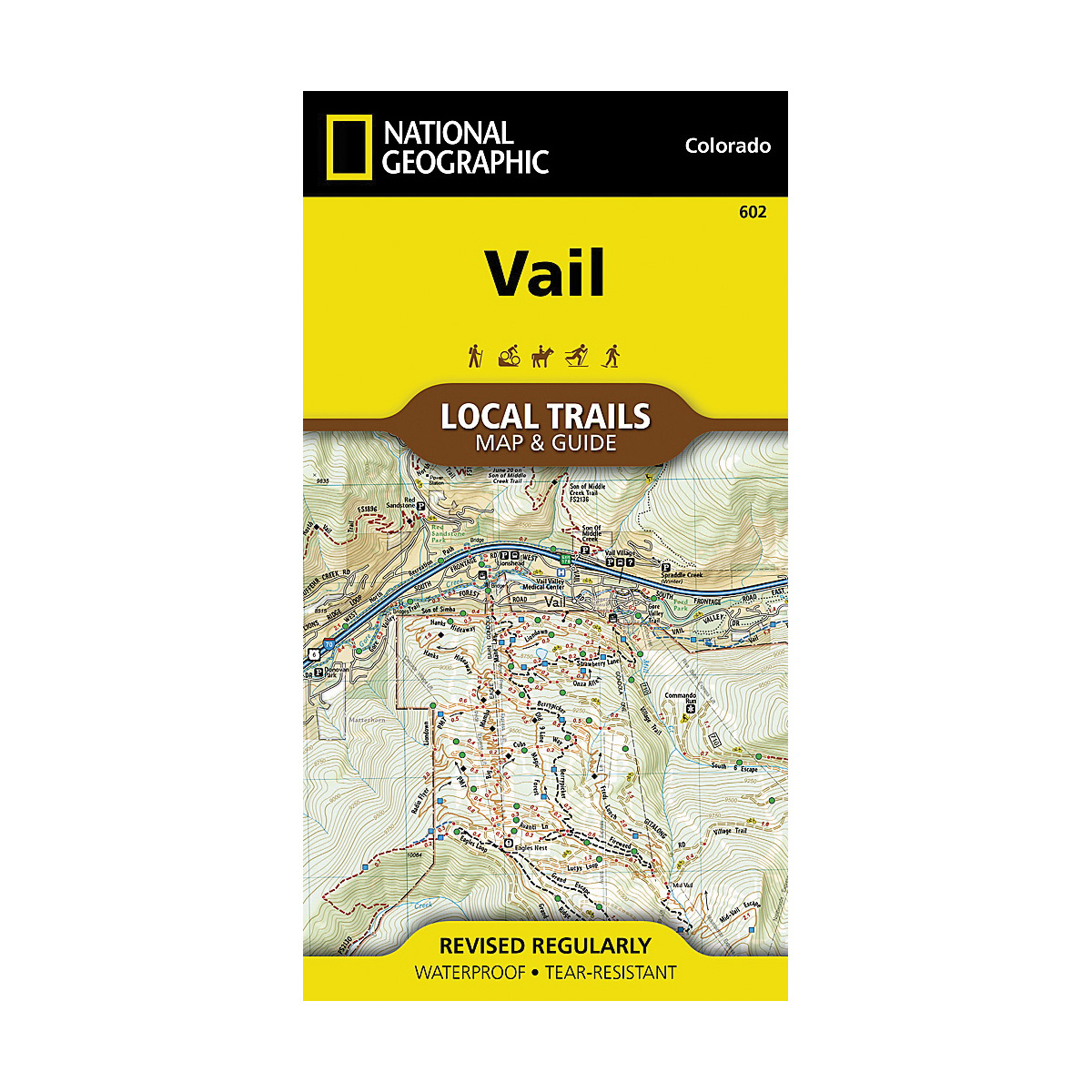
National Geographic TI00000602 Topographic Map, Vail

Promo Price:
National Geographic TI00000602 Topographic Map, Vail
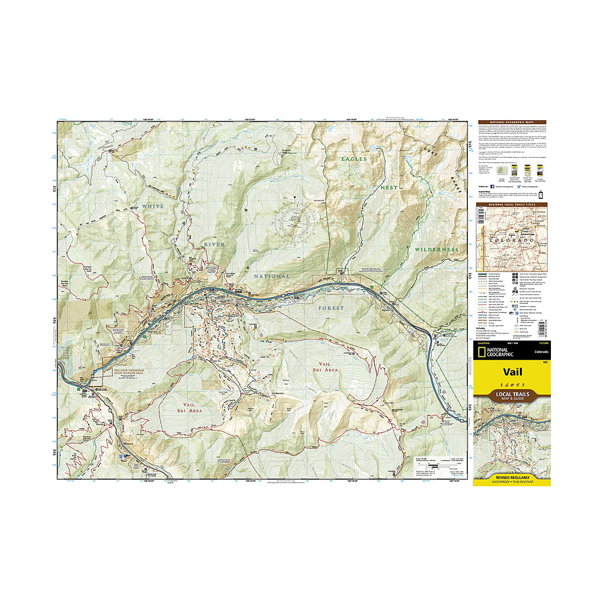
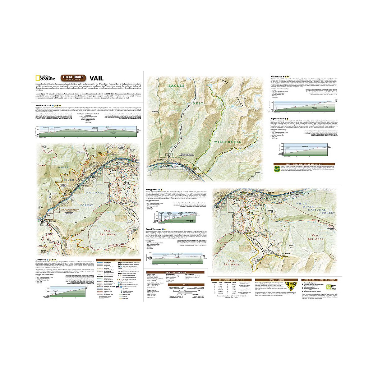
Situated at 8150 ft in the upper reaches of the Gore Valley and encircled by the White River National Forest, Vail combines one of the world's best alpine ski resorts with a friendly community that maintains its small-town feel. Visitors from around the world can find varied shops and restaurants, luxurious accommodations, bountiful cultural events and year-round recreational opportunities from hiking to skiing to biking. With so many outdoor recreation options, visitors to Vail have an enviable problem, where should they start? This map is a combination of a standard trail map on the front with a helpful guide on the back that has a selection of recommended hikes, from the moderate 2.9 miles Berrypicker to the strenuous 3100 ft climb up to Pitkin Lake. Each selected trail includes a brief description, specs such as elevation gain and length as well as a detailed elevation profile to track your progress up and down the numerous peaks and valleys. Each Local Trails map includes detailed trail maps at 1 in equals to 0.5 miles. At this scale every turn of the trail is clearly visible and when covering steep terrain the contours are clearly visible. In addition to the standard features like trailheads and parking areas the maps also show difficulties for each trail segment so you can tell if the entire trail is moderate or if there is only a single short section of difficult on an otherwise easy trail. Every Local Trails map is printed on "Backcountry Tough" waterproof, tear-resistant paper. A full UTM grid is printed on the map to aid with GPS navigation.
| Continental Coverage | Vail |
| Continental Coverage | Vail |
| Material | Paper |
| Material | Paper |
- 4 in x 7-1/2 in flat size