
Shop Products
- Gift Cards
- Apparel & Footwear
- Appliances
- Automotive
- Building Materials
- Cleaning
- Doors & Windows
- Electrical
- Hardware
- Fasteners
- Flooring
- Home Goods & Decor
- Heating, Cooling & Ventilation
- Holiday
- Lighting & Ceiling Fans
- Kitchen & Bath
- Lawn & Garden
- Paint
- Plumbing
- Outdoor Living
- Storage & Organization
- Pet & Wild Bird
- Sports & Recreation
- Tools
Services
Inspiration
About Us
Contact Us
Rewards
- Home
- Products
- Home Goods & Decor
- Office & Store Supplies
- Books, Maps & Planners
- Maps
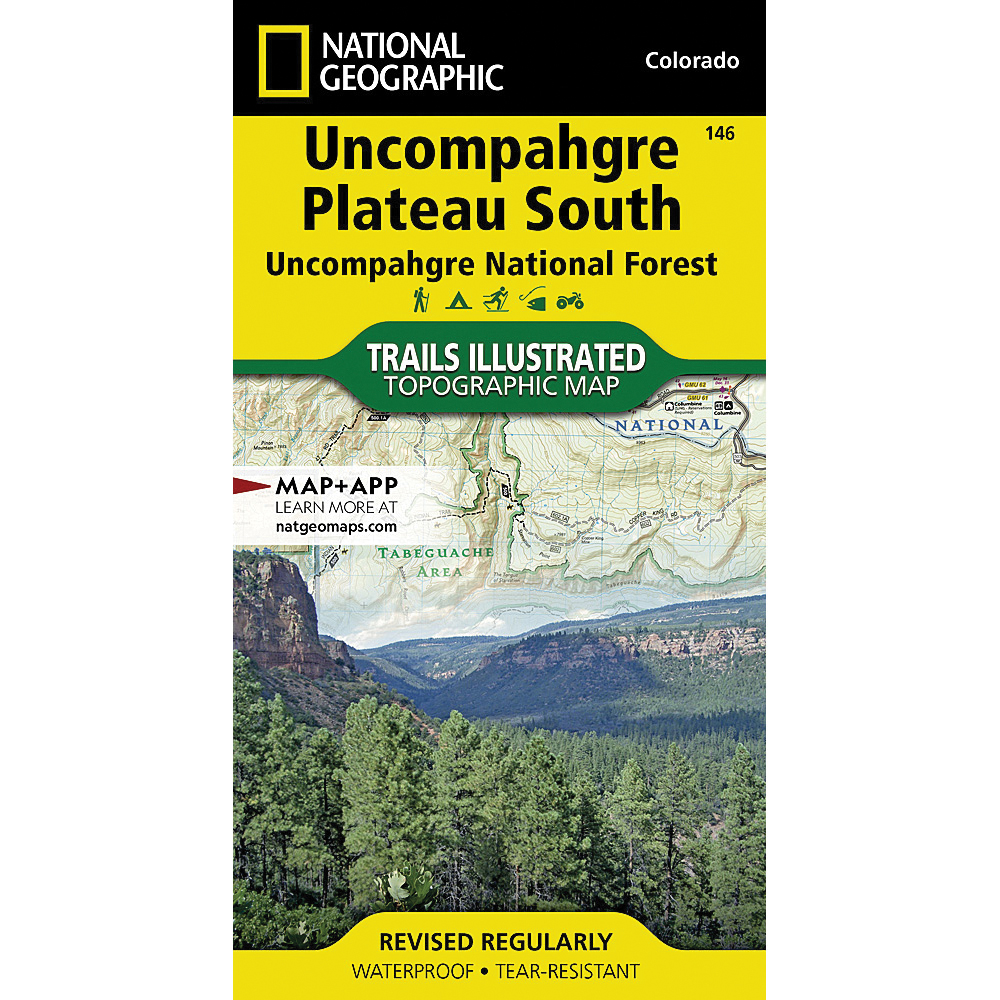
- National Geographic TI00000146

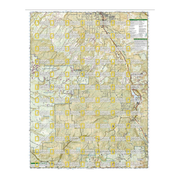
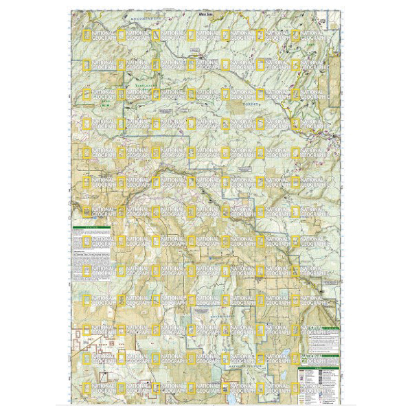
National Geographic TI00000146 Uncompahgre Plateau South Map, 37-3/4 in L, 25-1/2 in W

Promo Price:
National Geographic TI00000146 Uncompahgre Plateau South Map, 37-3/4 in L, 25-1/2 in W
National Geographic's Trails Illustrated map of Uncompahgre Plateau South is created for outdoor enthusiasts exploring the year-round recreational opportunities in this unique area in southwestern Colorado. Expertly researched and created in cooperation with the U.S. forest service, bureau of land management and others, the map provides unparalleled detail of southern Uncompahgre National Forest and River, Tabeguache and Roubideau Areas, Naturia Canyon, Wrights Mesa, Dan Noble and Dry Creek Basin State Wildlife Areas, San Miguel River and Canyon, Ridgway State Park and Tabeguache Trail.
| Continental Coverage | Forest and River, Tabeguache and Roubideau Areas, Naturia Canyon, Wrights Mesa, Dan Noble and Dry Creek Basin State Wildlife Areas, San Miguel River and Canyon, Ridgway State Park and Tabeguache Trail |
| Material | Paper |
| Length | 37-3/4 in |
| Width | 25-1/2 in |
- Every trails illustrated map is printed on backcountry tough waterproof, tear-resistant paper
- Full UTM grid is printed on the map to aid with GPS navigation