
Shop Products
- Gift Cards
- Apparel & Footwear
- Appliances
- Automotive
- Building Materials
- Cleaning
- Doors & Windows
- Electrical
- Hardware
- Fasteners
- Flooring
- Home Goods & Decor
- Heating, Cooling & Ventilation
- Holiday
- Lighting & Ceiling Fans
- Kitchen & Bath
- Lawn & Garden
- Paint
- Plumbing
- Outdoor Living
- Storage & Organization
- Pet & Wild Bird
- Sports & Recreation
- Tools
Services
Inspiration
About Us
Contact Us
Rewards
- Home
- Products
- Home Goods & Decor
- Office & Store Supplies
- Books, Maps & Planners
- Maps
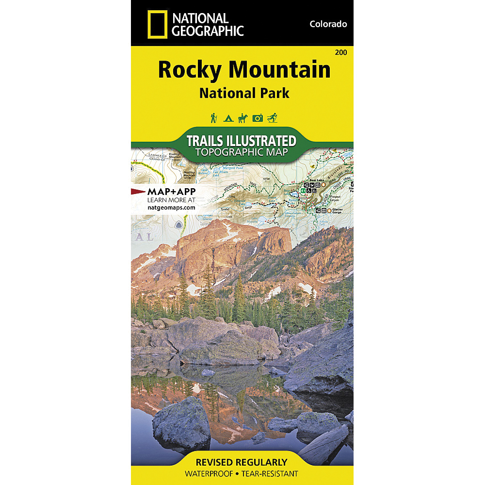
- National Geographic TI00000200

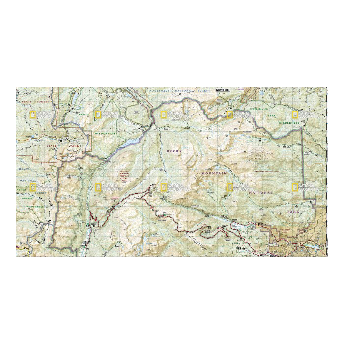
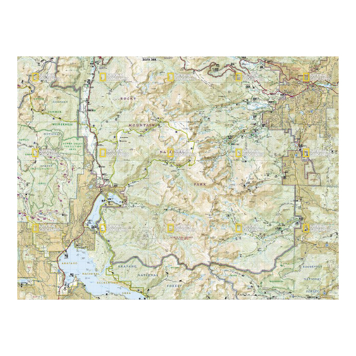
National Geographic TI00000200 Rocky Mountain National Park Map, 37-3/4 in L, 25-1/2 in W

Promo Price:
National Geographic TI00000200 Rocky Mountain National Park Map, 37-3/4 in L, 25-1/2 in W
National Geographic's Trails Illustrated map of Rocky Mountain National Park delivers unmatched detail and valuable information to assist you in your exploration of this breathtaking wilderness. Whatever the season, you'll find this map a useful tool in pursuing a host of recreational activities from camping and fishing to skiing and snowmobiling. Created in partnership with local land management agencies, this expertly researched map features key areas of interest including Trail Ridge Road, Longs Peak, Arapaho National Forest, Routt National Forest, Roosevelt National Forest, Never Summer Wilderness, Comanche Peak Wilderness and the Continental Divide Trail.
| Continental Coverage | Trail Ridge Road, Longs Peak, Arapaho National Forest, Routt National Forest, Roosevelt National Forest, Never Summer Wilderness, Comanche Peak Wilderness and The Continental Divide Trail |
| Material | Paper |
| Length | 37-3/4 in |
| Width | 25-1/2 in |
- Every trails illustrated map is printed on backcountry tough waterproof, tear-resistant paper
- Full UTM grid is printed on the map to aid with GPS navigation